
Knocknashee [Knocknashee Common] [Cnoc na Si]
Good walks are even better shared.
Overview
Knocknashee: A Hiker's Delight
Overview
Nestled gracefully in the heart of Sligo, Knocknashee stands as a delightful challenge for hikers looking to explore Ireland’s enchanting landscapes. With an elevation of 509 meters, it may not be the tallest peak in the area, but it offers a rewarding experience that combines natural beauty with rich folklore.
Geology
The unique geology of Knocknashee features limestone and sandstone, making its slopes a mix of rocky outcrops and lush grass. The karst formations around the area are not just beautiful but are a testament to the geological history of this remarkable region.
Trail Information
The primary route, the Knocknashee Loop Trail, is a moderate loop covering approximately 6.0 km. It takes an estimated two and a half hours to complete, allowing enough time for those inevitable pictures of the surrounding beauty!
Terrain and Summit
As you navigate your way up, be prepared for a mix of grassy paths and rocky areas, with some boggy patches that may challenge your balance—stumbling is all part of the fun! At the summit, you'll find a well-constructed stone cairn and a trig point, not to mention views that might just take your breath away – better not hold your breath too long!
Views
From the top, enjoy splendid sights including the rolling plains of County Sligo, the iconic Ben Bulben, and even the Atlantic Ocean on particularly clear days. For the best panorama, aim for spring or autumn, where the season’s colours will dazzle you.
Hazards
Be wary of slippery rocks, especially after rain. The weather can turn quicker than you can say “Cnoc na Si,” so come prepared. Watch out for those boggy patches; they have a knack for swallowing adventurous shoes!
Access and Facilities
Parking is conveniently located near the trailhead at G557193. Public transport options include buses from Sligo, which will drop you off at nearby Dromore West. The closest town, Ballaghaderreen, is just a short drive away and has some nice cafés to refuel after your hike.
History
The name 'Knocknashee' translates to 'Hill of the Fairies,' a nod to the enchanting tales that surround this mountain. Historically, it has held significance in Irish mythology, believed to be the home of the fairy folk.
Just remember, while you're climbing, try not to disturb their supernatural slumber!
In essence, Knocknashee is a perfect blend of hiking adventure, breathtaking scenery, and rich lore. You'll finish the trek with both fantastic stories and perhaps a newfound sense of respect for those mythical inhabitants!
Conclusion
So lace up your hiking boots and set forth to explore Knocknashee. Whether you’re in it for the exercise, the views, or the legends, you’re bound to leave with memories that linger longer than the fairy tales themselves.
Explore routes near Knocknashee [Knocknashee Common] [Cnoc na Si]
Walks starting near this hill. Open a route to check its map, distance and full itinerary.
Route planning notes
These notes describe possible approaches. Check a route's map and access information when planning your walk.
Knocknashee Loop Trail
A scenic loop trail that offers a mix of woodland paths and open hillside, providing beautiful views as you ascend.
Make a day of it, together
Find someone to share the walk with, or organise a day out along a route you like.
Hill facts and local notes
Classifications
Elevation
276m
906 ft
Prominence
175m
Coordinates
54.1191, -8.6798
G556191
OS Map
25
At the Summit
The summit boasts a large stone cairn and a trig point, providing a perfect spot for a photo op—just try not to look too windblown!
Terrain & Geology
The mountain is primarily composed of limestone and sandstone, featuring a unique mix of rocky outcrops and grassy slopes. The presence of limestone has contributed to the formation of some fascinating karst features in the area.
Views & Scenery
From the summit, you can gaze upon the expansive plains of County Sligo, the majestic Ben Bulben, and the Atlantic Ocean in the distance on clear days.
History & Heritage
Name Origin
The name ‘Knocknashee’ translates to 'Hill of the Fairies,' indicating its folklore connections.
Historical Significance
The summit has been a site of historical significance, rich in ancient mythology and believed to be the dwelling place of the Aos Sí (fairy folk).
Getting There & Facilities
Parking
There is a designated parking area near the trailhead at G557193, accommodating several cars.
Public Transport
Buses from Sligo town operate to nearby villages, with the closest service stopping at Dromore West.
Nearby Facilities
Limited facilities are available; the nearest café can be found in Dromore West, offering a hearty brew and some snacks. Toilets may be found in the villages.
Safety Information
Known Hazards
- Slippery rocks in wet conditions, potential for sudden weather changes, boggy areas can be treacherous.
General Safety Tips
- Check weather conditions before setting out
- Carry appropriate clothing and equipment
- Let someone know your planned route
- Take a map, compass, and GPS device
- Carry emergency supplies: food, water, first aid kit, torch
Hills
Some common questions about the hills answered
Are there group walks up Knocknashee [Knocknashee Common] [Cnoc na Si]?
Many walkers use Walkmates to join or organise walks with others. You can check for group walks around Knocknashee [Knocknashee Common] [Cnoc na Si] through the maps
Are there other walkers around Knocknashee [Knocknashee Common] [Cnoc na Si]?
Activity varies by location and time, but Walkmates lets you see whether others have shared walks or shown interest in this area. Find other people through the walking friends search walking friends for Knocknashee [Knocknashee Common] [Cnoc na Si] search or of course create your own walk for Knocknashee [Knocknashee Common] [Cnoc na Si]
Can I organise a walk to Knocknashee [Knocknashee Common] [Cnoc na Si]?
Yes. If there aren’t any walks listed already, you can create a walk and make it available for others to join.
If you're signed up to Walkmates, you can create a walk to Knocknashee [Knocknashee Common] [Cnoc na Si].
How do I find a walk up this hill?
There are often multiple ways to walk this hill, depending on experience and route preference. Walkmates helps you explore walks and routes that others have shared.
Can I suggest a new route up Knocknashee [Knocknashee Common] [Cnoc na Si]?
Yes. You can suggest or create routes to share with others. Walkmates focuses on the social side of walking, so routes are used to help people organise walks and explore areas together, rather than as detailed navigation tools or route libraries.
Other uses really appreciate knowledgeable walkers sharing their routes. Share your favourite route to Knocknashee [Knocknashee Common] [Cnoc na Si] here
The is an error or something incorrect about this hill. How do I let you know?
We always strive to keep the information on Walkmates as accurate as possible. If you find an error, please let us know through the contact form and we'll aim to correct it as quickly as possible
Community Discussion
Comments
Location
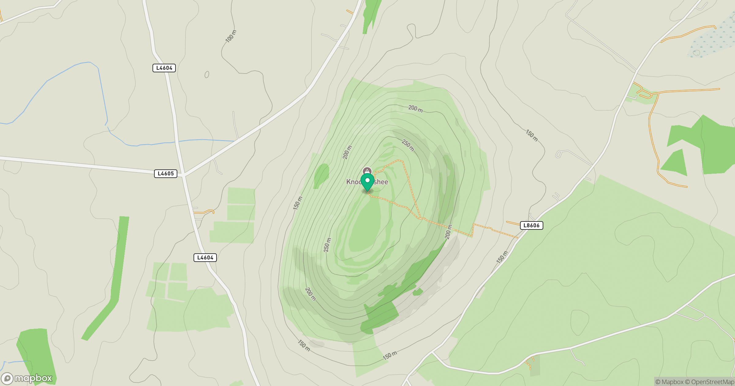
Grid reference: G556191
View on OpenStreetMapOpens a map in a new tab, centred on the hill.
No comments yet. Be the first.